
The day I arrived at Zealand Falls Hut I had heard rumors of good weather to come. Considering how much I had heard about the Whites, particularly the Presidential range, having the worst weather in the country, I decided to pull out my guidebook and draft a solid plan for the following day.
From Zealand Falls hut I would proceed towards Mount Washington along a smooth, steady trail for 6 miles until I passed Ethan Pond Campsite. From there it was a steep, 2000-foot descent to Crawford Notch resting at 1263 feet before a 3000-foot ascent up a gradual slope to Mt. Webster for 5 miles. Then I would hike 4 more miles to the Mizpah cutoff where I would pass a hut before entering the alpine zone. Another 5 miles of alpine hiking 1300 feet up the trail from there was the Lake of the Clouds Hut, nestled near the base of Mt. Washington’s summit ridge at 5106 feet. The Lake of the Clouds hut was my last chance for shelter before committing to the most exposed, extreme weather-prone section of the trail.
I estimated that if I started early enough, I could make my way to Mizpah by noon. That would give me plenty of time to assess whether or not I could safely proceed to summit Mount Washington with the option of posting up at Lake of the Clouds if the weather ended up being volatile.

By 6:50 am I was out of the hut. The weather was perfect for hiking, cool with a steady breeze to keep sweating to a minimum and enough clouds in the sky to keep the sun from being a nuisance. Anxious to get going, I popped in the headphones and started making my way to the trail at a brisk pace. Just as I was leaving one of the girls working at the hut ran out and gave me a full loaf of bread they had baked the night before. I thanked her, ate half of it, stashed the rest, and continued.
As expected, the trail was smooth as glass (at least compared to the rest of the New Hampshire) and I made excellent progress. Passing a sign that directed hikers towards a scenic waterfall a third of a mile off the trail, I decided I could afford a small detour to smoke a little weed.

I booked it down to Crawford Notch where I ended up bumping into two NOLS alumni sitting by the road. They had just returned from a backpacking course in Patagonia and were headed out to hike Mount Washington in two days. Upon hearing that I was shooting to summit that afternoon, they bid me good luck before I proceeded across highway 302 towards the Webster Cliffs looming high above me.
The elevation profile in my guidebook ended up being very misleading as the trail wasn’t steady at all. At times, the path hardly passed as a trail. It was mostly comprised of sections of rock scrambling connected by short segments of uneven trail amongst rocks and roots. Some sections of the scrambling were steep enough to compromise the thru-hike if I were careless and slipped. It was crushed nonetheless. I passed was a large group of French-Canadians who made less-than-tactful remarks as I overcame them. I made sure to bless them with flatus as I passed.


I made my way to the top of the cliffs where I proceeded to re-up on marijuana and knock out another large chunk of the bread Abby gave me. The day was starting to warm up, not to mention I was already sweating like a pig from rapidly ascending the 3000-foot cliff. Regardless, I was feeling great and looking forward to the rest of the day considering most of the steep sections were behind me.
I proceeded along a smooth, forested path to Mt. Jackson where I emerged upon a rock outcropping elevated above the surrounding trees. For the first time, I was able to see Mount Washington. Surrounded by its sister peaks with its summit shrouded in clouds, the last major obstacle before Katahdin looked absolutely magnificent.

I was beginning to feel exceptionally stoked. It just around noon and there was plenty of time for the weather to clear up for a summit attempt. Worst case scenario, I was making it to Lake of the Clouds that day.
There was a group of bros standing on top of Jackson enjoying the view as well. Like most people I’ve been meeting this late in my journey, they were star-struck by the fact that I was a thru-hiker. The White Mountain National Forest receives a lot of visitors from nearby population centers like Boston and New York, the vast majority of them being day or weekend hikers. Some of them have no idea what the Appalachian Trail is, and even the ones who do are astonished whenever they bump into us (especially this early). Earlier on in the hike, I was treated as just another hiker with plenty of miles to go. Now that I was over 1800 miles in and proceeding through the hardest section of the hike, a lot of the people I encountered treated me like a superhero. This was great because they usually gave me food.
We chatted for a bit about where we’ve traveled and lived. One of the guys mentioned that he’d been living in Breckenridge, Colorado for the past two winters. A bro-ment ensued when I shared that I had as well and we, without saying a word, understood that we had both shared the same experience of waking two hours earlier than we would for work on a day off to feel our hearts drop to the pits of our stomachs as we plummeted over a cornice into chest deep powder before subsequently flying through the trees in the legendary glades of the Tenmile Range.

They bid me good luck as I made off towards the Mizpah Spring Hut to fill up on water and feast on some leftover pastries they had available for sale. There I read reports that the weather would continue to improve for the rest of the day. Eager to seize the opportunity to summit Washington in good weather, I quickly stuffed the pastries into my face after having a brief conversation with yet another NOLS alumni and headed out.
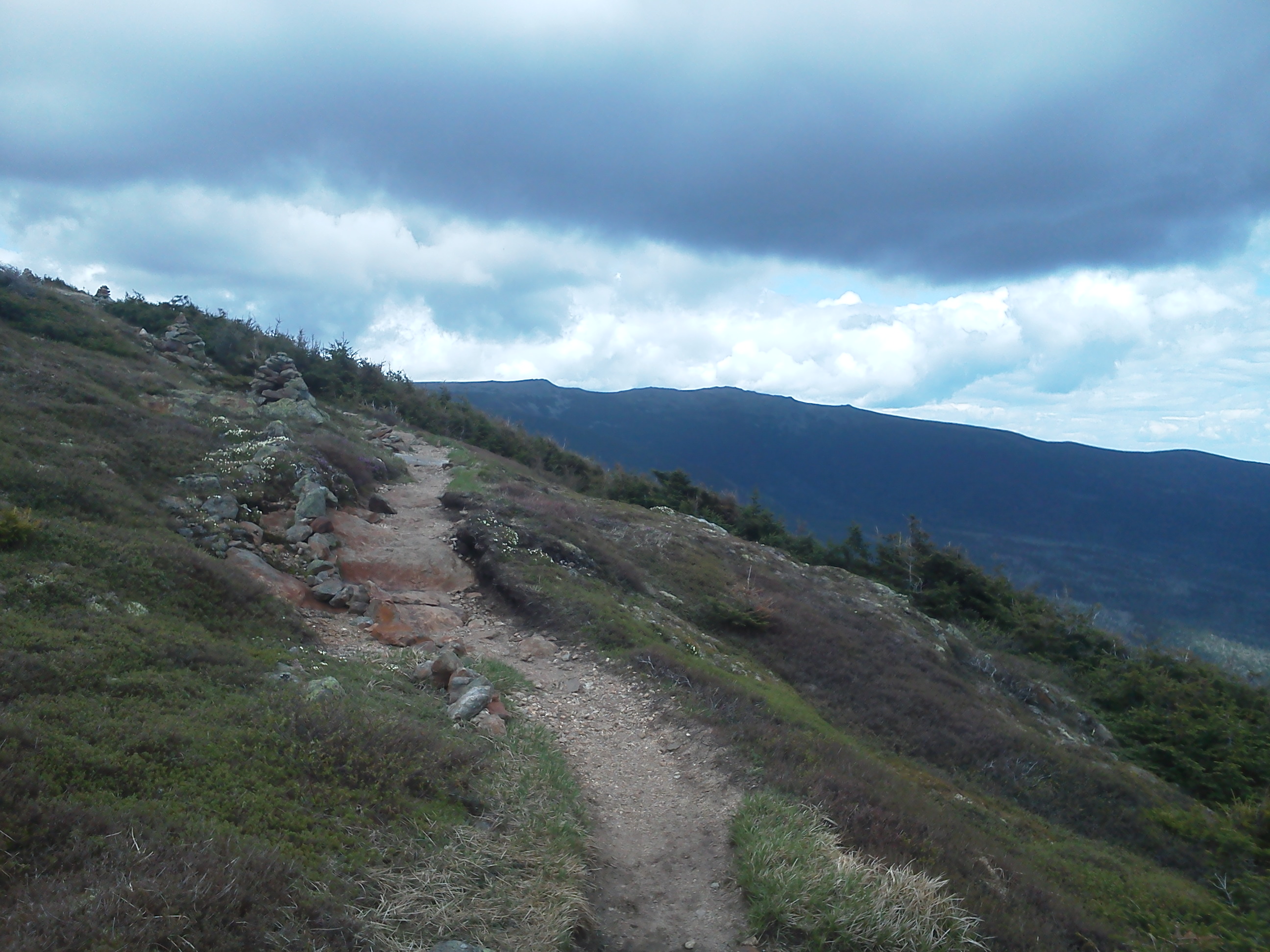
I quickly made my way up a 500-foot climb and proceeded above treeline. Per my ritual, I removed my headphones and allowed myself to zone into the powerful alpine world. The Presidential Ridge extended miles before me, a bare stretch of rock and alpine vegetation created by the region’s notoriously extreme weather. The ridge had seen much worse than the conditions I experienced that day. A mild breeze was flowing across the mountains while the sun occasionally burst through the clouds, creating perfect hiking temperatures. The good weather and the weekend brought summer crowds, appearing as specks of color peppered across the ridge before me as they made their way up the Presidential Peaks.
Best of all, the summit of Washington had cleared completely.

I was on fire. I passed group after group of hikers as I zealously proceeded along the ridge, completely relieved of any concerns about conditions for my impending summit. I briefly paused for yet another toke when I approached a sign at an intersection, one path continuing along the AT, the other directing me an additional two hundred feet to the summit of Mt. Eisenhower. With great weather and time to spare, I elected to follow the path to Eisenhower’s peak.
The conditions couldn’t have been more perfect. Strong gusts were cooling the sweat on my body while the sunlight illuminated the alpine flowers around me. No words nor pictures could ever do such a moment justice. Every alpine summit I have ever reached has cultivated an experience that can only be understood when felt. Nothing can be said or shown to help me convey what is so rewarding about being in those moments. The joy of a summit and the challenge of getting there is a novelty that can only be obtained through the desire to be there, and I think everyone owes it to themselves to experience one at least once.


Soon enough I was at Lake of the Clouds Hut, nestled in the saddle between Mt. Monroe and Mt. Washington at 5000 feet. A popular destination for tourists who drive to the top of Mt. Washington, the hut was crowded when I entered to quickly hydrate and attempt to yogi (like the bear, not yoga) some food from the staff. With nothing for them to spare, I made my way back outside where I was greeted by an intense gust of wind. Despite having already trekked 19 miles up 4,300 feet that day, I was feeling pretty amped and had but one final push up a barren rocky slope to the summit. The last 1000 feet took no more than a half-hour.
As much as I hate to say it, the summit was a bit disappointing. A handful of buildings catering to tourists and weather researchers had been erected all over what would otherwise be a quiet, desolate peak. There were people everywhere. Families with their screaming kids, Harley Davidson riders with their noisy bikes, clueless city-dwellers asking me to take their picture. I quickly made my way past all the riffraff to the north end of the summit. The wind was powerful, chilling me to the bone and drowning out the noise generated by the hundreds of apes behind me. Just as I was able to forget about the ruckus, one of the bikers offered to take my picture in exchange for me taking one of his buddies. I didn’t mind so much, so I snapped a quick shot of him before briefly explaining to him what I was doing. As he walked away shouting to his friends in utter disbelief, I took one final look at the alpine ridge behind me and continued on my way.


The remainder of my hike was an enjoyable cruise over Mt. Jefferson to Madison Spring Hut. Thankfully the day was becoming late and crowds had begun to diminish. My legs were starting to feel pretty rough, my knees rattled with every step downhill and the skin on my heels was rubbed raw from all the friction through the day. I was exhausted by the time I pushed over Thunderstorm Junction and where I was relieved to see the Madison Spring Hut nestled in the notch below.
Thankfully I was the second hiker to arrive and the energetic caretaker was happy to allow me to do a work for stay. I took the time to talk to other hikers at the hut and met Cannonball, who had been just ahead of me on the trail for a couple of days. I carried plate after plate of food outside the hut to feast with the hut staff, who were all incredibly friendly. Following dinner, I polished some silverware before having one final safety meeting and crashing in the dining hall.


I stuck around for breakfast the next day before heading out to summit Mount Madison before making a 3,000-foot descent into the valley below. I. Was. Wrecked. The previous 28-mile, 6,500-something vertical feet of elevation gain day across an abundance of gnarly terrain had taken its toll. My knees were shit, my feet were raw and bleeding and sure enough, I even got my first blister. I swallowed some ibuprofen, which I had been avoiding throughout the hike, and toked to remedy the pain but little could be done.
Madison’s descent was a steep, rocky scramble that would have sucked even on fresh legs. I had talked to Cannonball the day before about making our way 21 miles to a shelter in the Wildcat range. No more than an hour or two into my hike it was clear that wasn’t happening. After heading down 3,000 feet I made my way along a decently smooth path for 5 miles before hitting yet another steep, rocky 2000 feet of uphill. I sucked it up and kept a slow, steady pace to the top of Wildcat Mountain. Shortly before my final descent down to Carter Notch Hut, I bumped into a section hiker named Sam. We made good conversation as I knocked out the last 3 miles to the hut, a steep 1000-foot scramble to a pair of small mountain lakes. I was glad to have the company of Cannonball and the awesome hut staff that evening as I once again feasted on leftovers.


The following day was also pretty rough. It began with a 1500-foot scramble up another insanely steep pitch before a final 15-mile push to US 2. The last 3 miles were pretty stressful. Not only was my body falling apart, but I was relentlessly attacked by mosquitos and black flies to the point where music couldn’t even distract me from my misery. I didn’t bother stopping to rest when I arrived at the road. I headed straight to the White Mountains Lodge & Hostel where my mom had shipped a care package. The caretaker, Barstool, was nice enough to offer me a ride into town that I happily accepted. I headed to the library to hastily dish out my previous blog post over an hour before heading to the buffet down the road. I was considering heading back to the trailhead to stealth camp but elected to post up at the Hiker’s Paradise Hostel in town with Cannonball.

Even though we made a quick day of getting to town and I was able to get off my feet for an entire afternoon, I couldn’t help but agree with Cannonball when he proposed we take a zero-day. I suggested the White Mountains Lodge & Hostel where I picked up my mail, as it appeared much more accomodating than the place we stayed at the night before. It also was located right on the trail and included free laundry AND breakfast. Decision made.
We caught a ride back to the trail and made our way to the hostel where we were greeted by Marni and Molly. They checked us in and showed us around their lovely establishment. It’s safe to say it’s the nicest hostel I’ve visited on the trail. The bunk rooms are incredibly nice (one is David Hasselhoff-themed), the caretakers are amazing, and we are given full access to the house. Best of all, I’ve been provided several hours of computer access so I could dish out this 2500-word novel of a blog post before heading off to Maine tomorrow. If you’re hiking the trail, be sure to make a stop here if the Whites beat the crap out of you. It’s homey.

So, Maine tomorrow. It’s a bit surreal to be at the edge of the last stretch of the greatest journey I have ever embarked on. Ahead of me, there is still a good 300 miles to dish out over the next two weeks and a lot of the terrain continues to be challenging. I also happen to be heading into Maine during its notoriously intense black-fly season. In any case, I’m confident about heading towards the finish line on fresh legs after an excellent zero day here at the hostel where people are beginning to give me crap for spending so much time typing this.
Watch out Katahdin, here I come!
My last maildrop location has been updated, and you can probably expect one more update before I’m at the finish line. Thank you everyone for your continued interest and support, there are no words for how much I appreciate it!
– Crush
